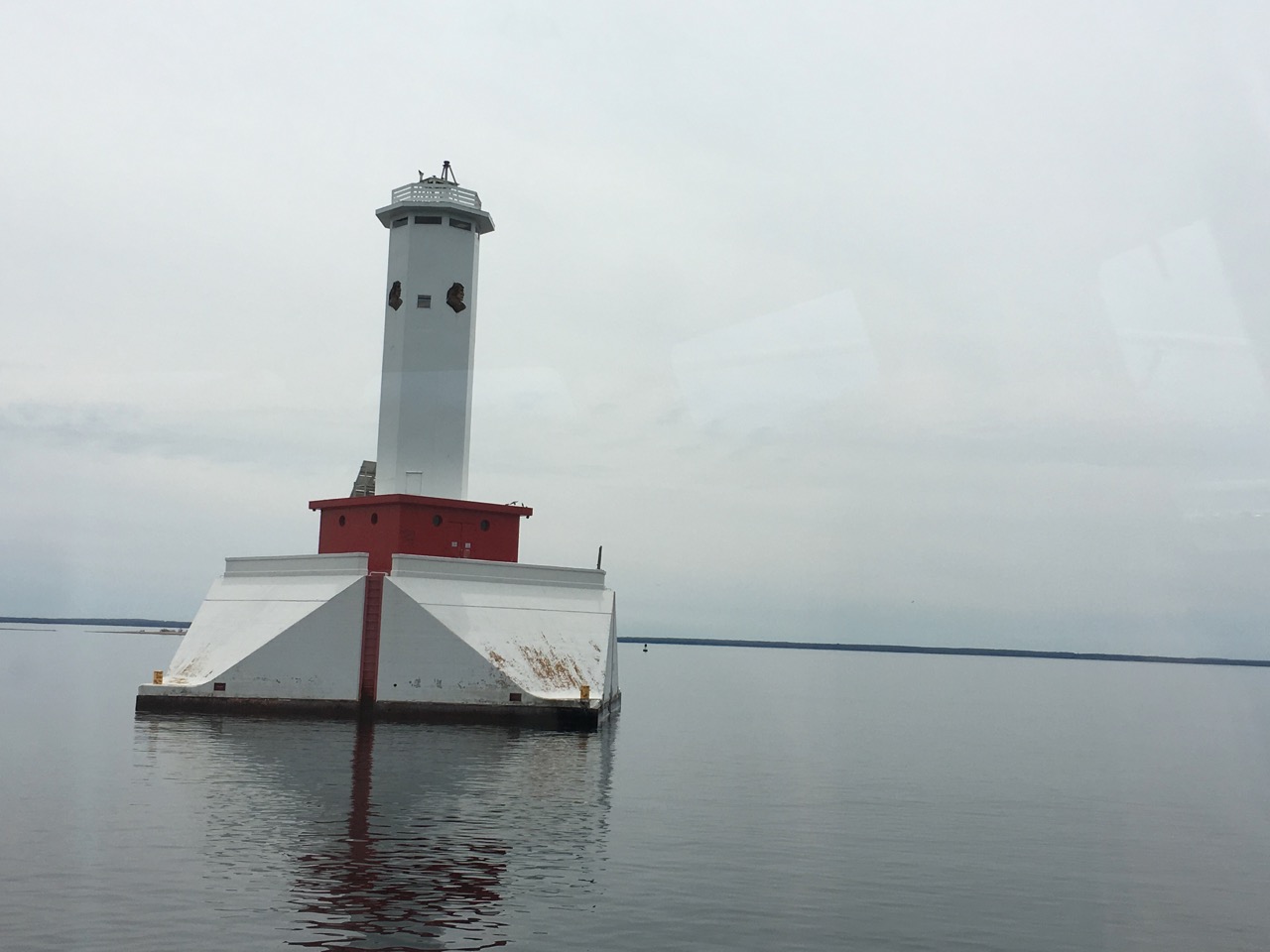
 Happy Lighthouse is Happy
Finding a time that all of the family schedules line up, and is not so last-minute that activities are sold out or excessively expensive, led to an over-accumulation of vacation time at the end of the year. As I’m less a fan of “losing vacation time” than “vacationing in winter,” I’d take a few days off, but we’d invariably sit around the house as everyone equivocated about what they didn’t want to do.
This year, I was fortunate to have an excuse to head out to Wisconsin to see some of my daughter’s dance performances. Even better, I could add a few days to see some other things. Since I’d been west before, I thought I’d visit northern Michigan (especially after contemplating a couple of bike rides in earlier years). The logistics were challenging because there were no major airports nearby. Minor ones — Milwaukee, Appleton, Green Bay, Iron Mountain, Chippewa County , Pellston, and Traverse City — had limited itineraries or car-rentals agencies that made a one-way trip prohibitively expensive. Detroit and Chicago, though well-connected, extended the already long drive. Also, since this was slated for May, the two ferries across Lake Michigan weren’t running as convenient schedules.
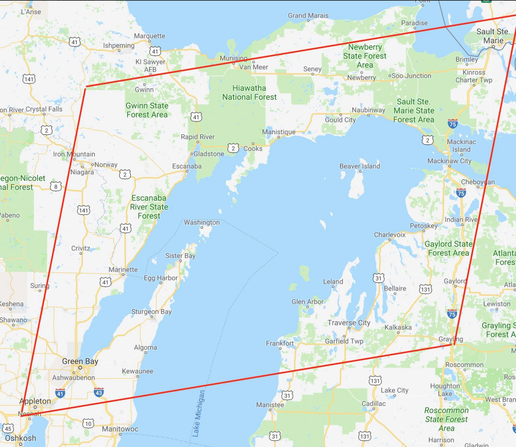 The peninsula quadrangle area of travel interest
Notes from the trip:
**Traverse City – **was my home base for the first two nights. The Grand Stay was okay enough, but I should have checked the price difference between days. (Day 1: $48. Day 2: $175.) The difference would have motivated me to get to St Ignace sooner for the Lighthouse Boat cruise.
- GC36, the second earliest geocache in Michigan, of interest because it fills in the rare August 2000 placement date in my “Jasmer grid:”
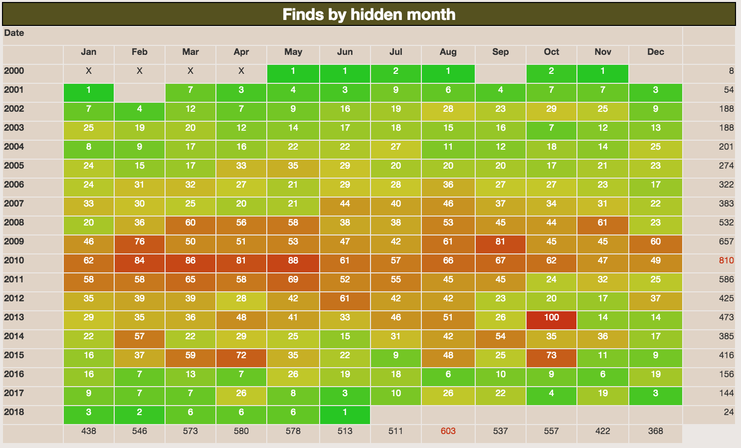 Jasmer Grid – finds by hidden month
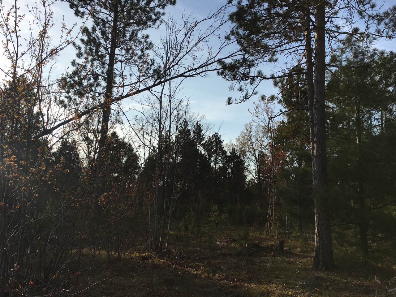
It was about 40 miles east of Traverse City, down some dirt roads that got sandy enough to tax my rental. I had enough daylight after my flight that I squeezed it in there rather than lollygagging around the hotel. The location itself was not especially memorable, but a check box on a random geocaching challenge was obtained:
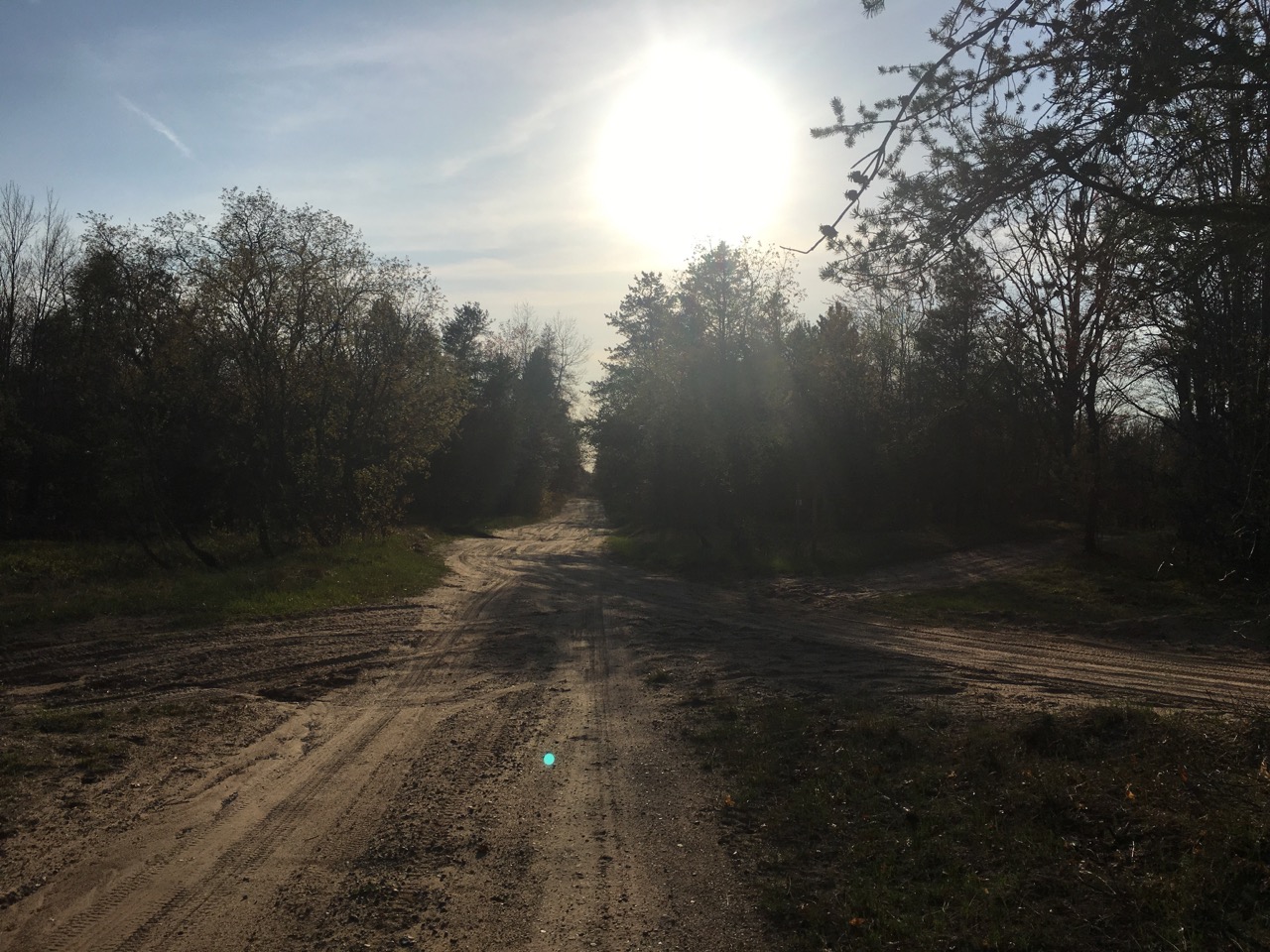 Random dirt road near GC36
 GC36 50m ahead.
* **[GC35][10] –** Michigan’s _oldest_ cache (July 2000), on Power Island. It is accessed via charter boat or personal watercraft. Since I was traveling solo, I was able to hook up with another group of other geocachers who’d already done the logistics. The guy on the left developed Ms Pac Man for the Atari.
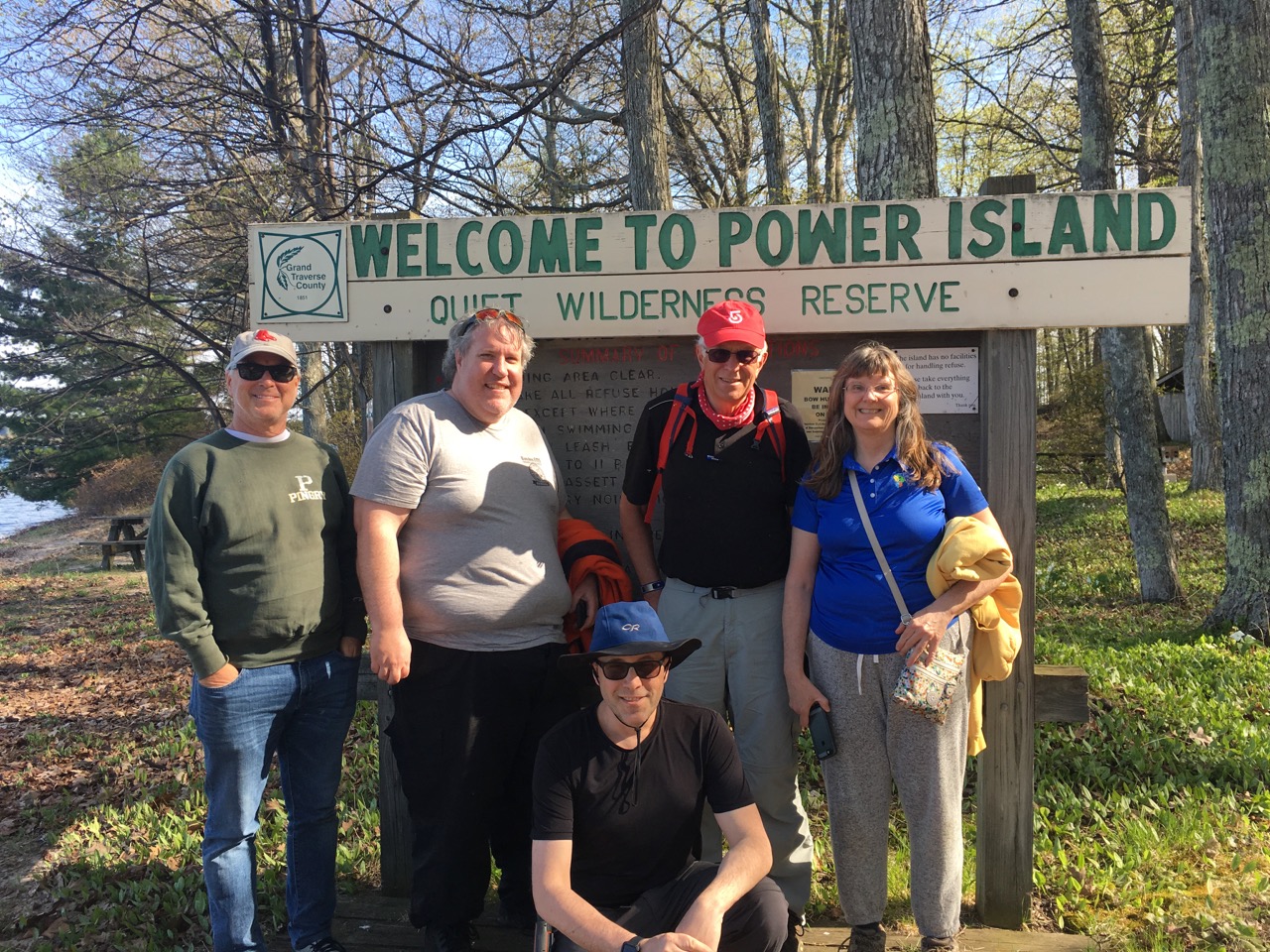 GC35 – Power Island
Everyone enlists the services of Captain Mike, who was quite the character. He charges $350 for the trip (we split 5 ways). We left from Greilickville harbor park, near Traverse City. The tactical pants, T-shirt and goofy hat were fine, but I wish I had brought insect repellent. As this was early-season, the trails were somewhat overgrown, but still navigable. Fortunately, _no ticks were acquired._
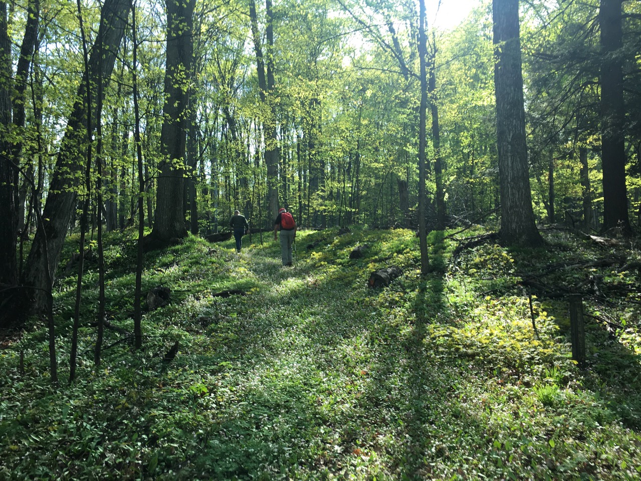 Power Island
    Total time needed for all the caches on Power Island was about three hours.  This was a nice way to spend an evening.  The other four folks were going to head out of town to get More Old Caches.

      * [**Sleeping Bear Dunes National Lakeshore**][13]. While pretty, it was also _very hot_ here.  The most entertaining aspect was watching a slow-motion disaster: despite abundant signage warning otherwise, some middle-aged guy, egged on by his so-called “friends,”  barreled down the dune to walk along the water’s edge. I did not stick around, but imagined he was very sad-face with that decision when he realized he had to hike up 450′ elevation gain in hot weather.
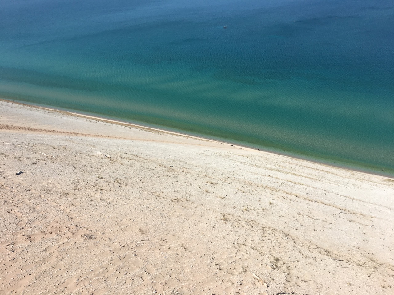 That little speck near the water will soon be a very sad man.
        **St. Ignace** is just north of Mackinaw City, and was my base for the next three days.  The [Sunset Hotel][15] was very inexpensive (~$48/night), quiet and comfortable.  St Ignace doesn’t have a lot in it in mid-May.  However, ferries ran from both sides.

          * [**Mackinac Island**][16] – this is a car-free island near Mackinaw City.  I had heard, indirectly, that this was a nice area to visit, so why the heck not.  Turns out, there are also a lot of geocaches, too.
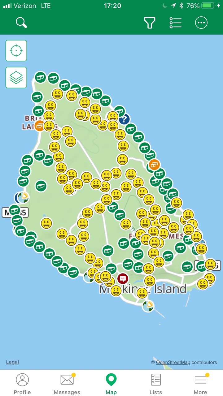 More than I could get in a day… on Mackinac Island
            I went out the first ferry from St. Ignace. The half-marathon of hiking was delightfully serene. During the day, I found 70 geocaches, limited only by needing to get on the last ferry back to St. Ignace.  While I had adequate snacks, I did not bring nearly enough water, nor did I find obvious free sources on the north end, where I was hiking (and no stores, either).

            My original thought was to spend a day on Mackinac Island, a day in Sault Ste Marie, then head west. However, after posting my find map on Facebook, my friend Phil noted that I had “missed one.” Argh. Must fix that!
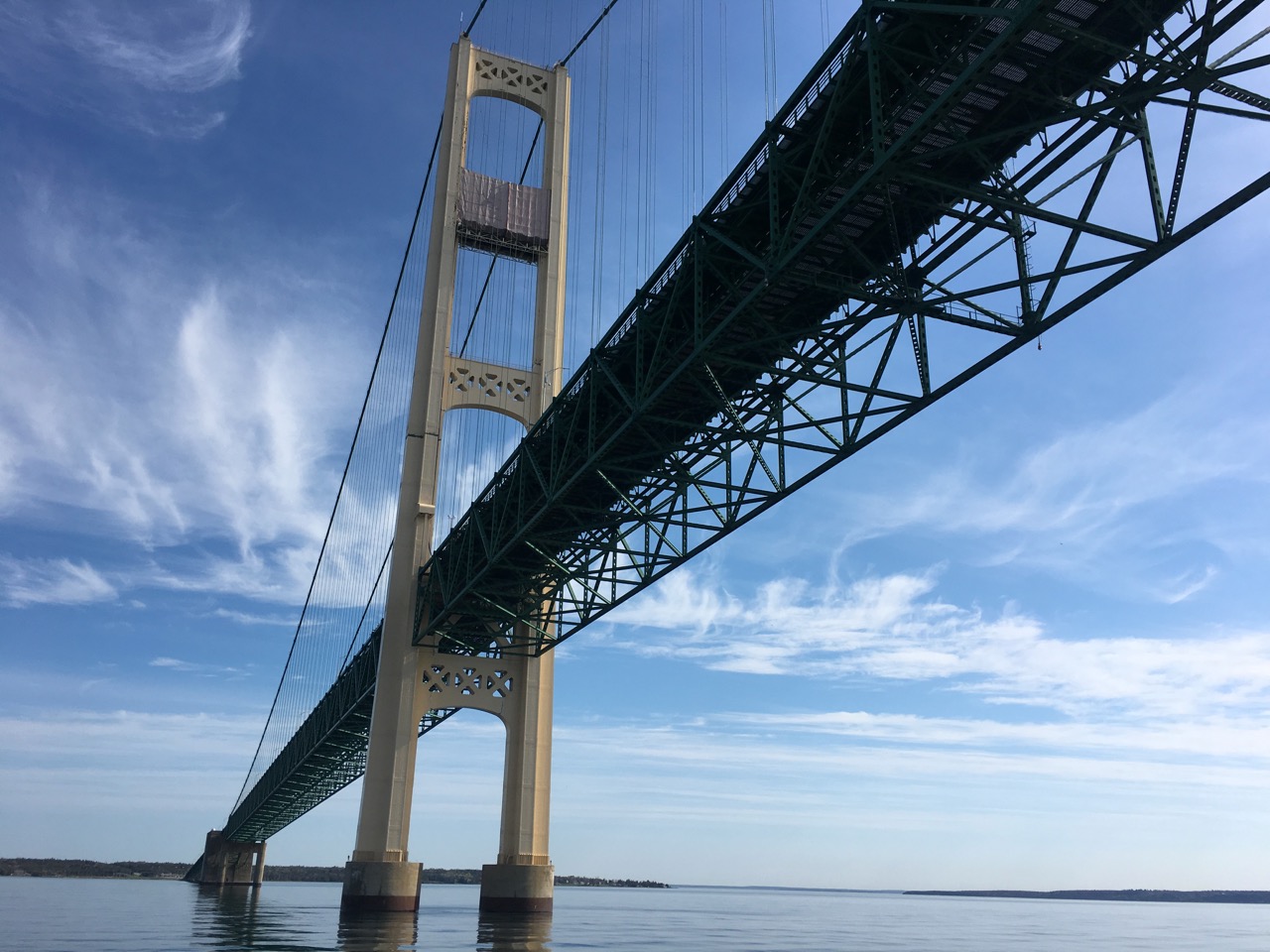 ***All your bridge are belong to us – Mackinac ***
            I took a later ferry that offered a diversion under the Mackinaw Bridge — which necessitated getting a bridge T-shirt before leaving.

            I hoped to work around the perimeter of Mackinac Island; however, about two miles in, the clouds of black flies were so horrid, that I reconsidered and trekked inland to less buggy areas.  I ended up with another 20 caches, but came home early afternoon to do some laundry.  _Fun Times!_
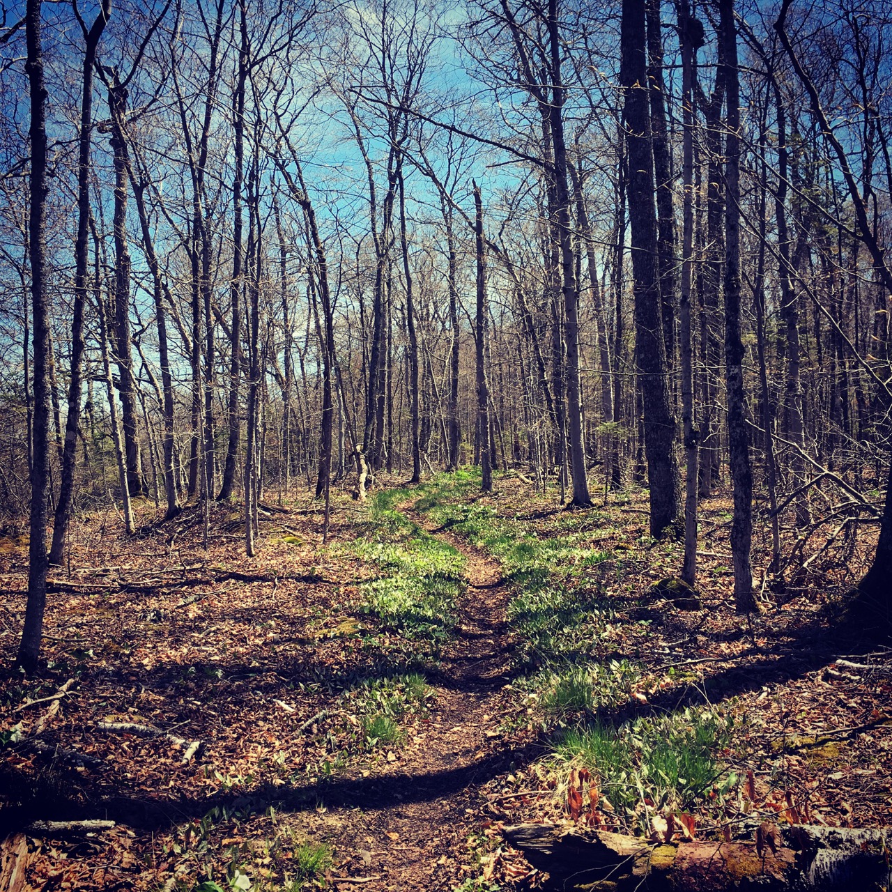 Mackinac Island
Since I had nothing else planned for the area, I headed north to **[Sault Ste Marie][20] **to visit Canada and find geocaches in Ontario before heading west. I discovered Google Maps’ newest feature for noncurrent pilots: holding patterns. Several times, it would suggest taking random diversions for no other reason than showing me I didn’t need to be anywhere important:
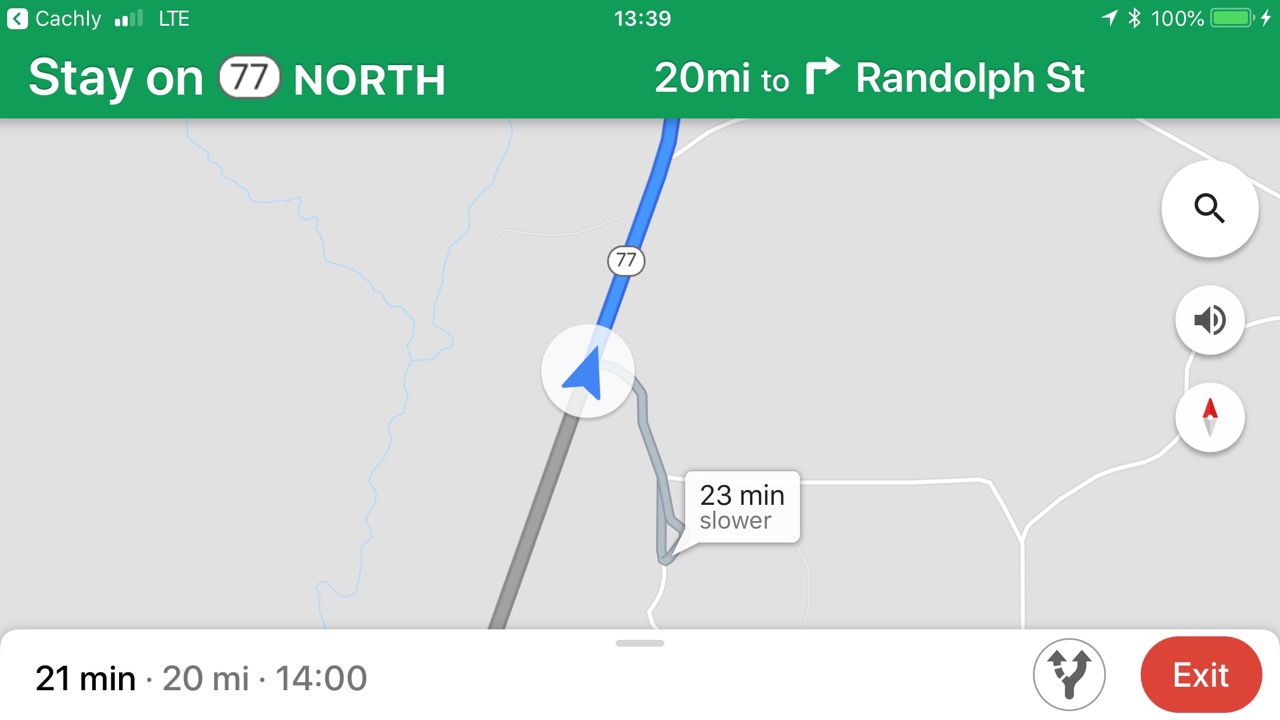 OK, Google, traffic is flowing well. I need a 23-minute delay
I pre-solved a lot of puzzles… but after the drive, decided to stick around Whitefish Island and hike.
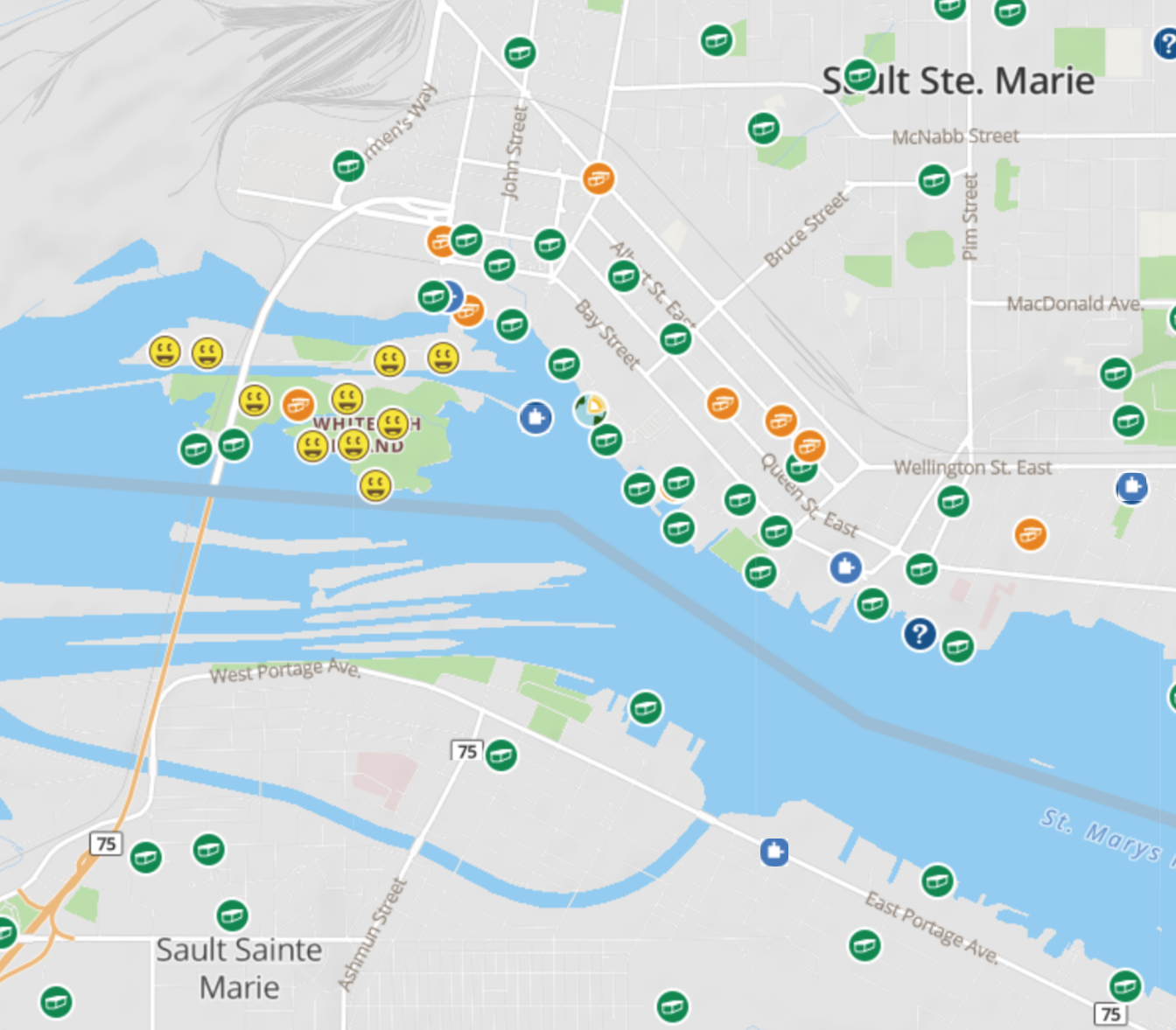 Sault Ste Marie – barely.
The best cache was a tour of Soo Locks, ending at this rail swing bridge.
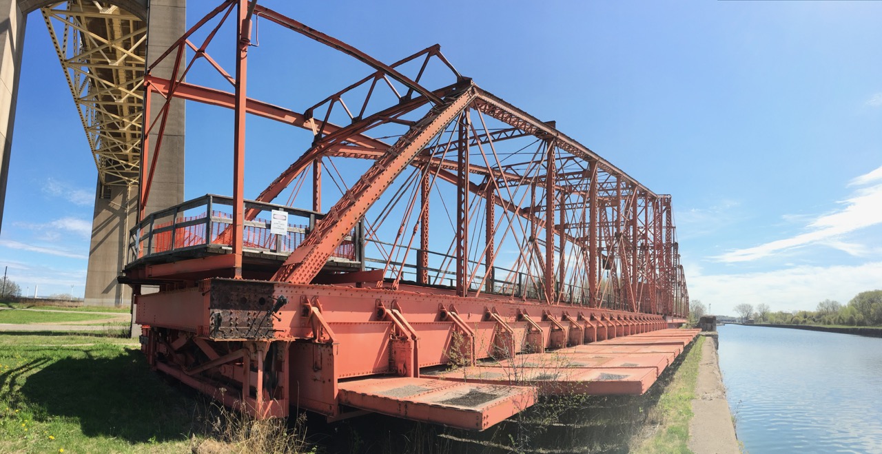 Swing Gate