When I was working the rides booth at the Seattle Bike Expo, I was looking for an event that would be physically demanding but fun. Initially, RAMROD seemed like a great option, however that sold out. Tour de Blast sounded intriguing because it was an out and back on roads leading to Mt. St. Helens. The folks who went on it consistently glowing comments, so I signed up.
Today was ride day…
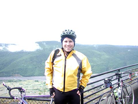
Next year when I do this ride, I’m going to spring for a nearby hotel. The drive in took nearly three hours, including two potty stops, and I was feeling kind of groggy. I found parking right in front of Toutle high school. After stretching a bit, I went to the bathroom and then got in line for my T-shirt. One of my coworkers had come over the night before with one of his friends. Both look more rested than me.
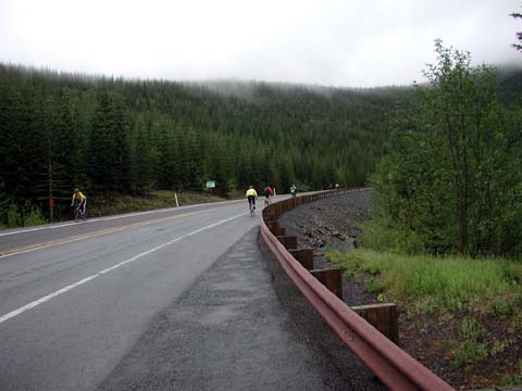
I got to the Elk Rock rest stop in pretty good shape. However standing in line for the porta-potties for 20 minutes in the downpour didn’t help. Lots of riders were huddled under the shelters, and I started getting chills, so…I figured I’d motor on to warm up. Visibility was worsening quickly, maybe 50-100′, and I wasn’t warming up at all, so I bit the bullet and turned around. Before I did, I pulled down my balaclava, put on my long-fingered gloves and tightened the straps on my jacket. Cold and shivering, I just went down the hill as fast as I could control it, averaging about 35mph for the next several miles. My feet felt like pontoons as they were being pelted with the spray coming off my tires. In retrospect, I should have Hofstadt to warm up near the fire.
Once I hit the flat portion, I had some minor cramps and took another several miles to re-warm up. The last few miles into the headwind were otherwise uneventful.
The men’s showers were spewing only cold water. I rinsed off the extremeties and bundled up with warm clothes before heading out to the pasta feed. I also thought it was really cool they had ride photos ready, and cheaper than Marathon (who does CBC events). I fell asleep in my car for an hour before heading home.
I’m definitely planning to do TdB next year, and may be making a trip out there in July.
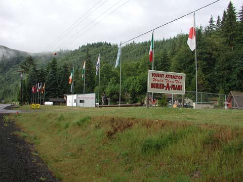 |
Tour de Blast starts at Toutle Lake High School, about ten miles east of Castle Rock. The first ten miles are relatively flat. The ride dips down to the river in an area called Maple Flat, the site of the buried A-frame house completed just before the volcano erupted. The owners dug it out and made it into a tourist attraction. Thankfully it was really early in the morning, otherwise I might have been tempted to see what, exactly, a buried A-frame house is and why people would be charging admission. (Okay, not really.) |
Tourist Attraction |
|
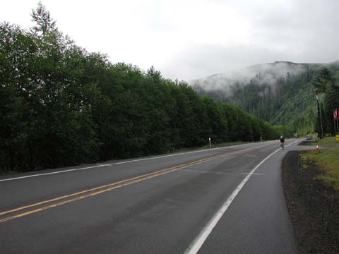 |
The road and river both make a big bend, and we start up the first climb of any significance. So far, we’ve been on the section of the highway unscathed by the volcano. After 12 miles, we’ll see the newly constructed portion of Spirit Lake Highway. The original highway, now buried under tons of ash, soil and rocks, wormed its way up the Toutle valley floor. The new highway is cut into the valley ridges. |
 |
|
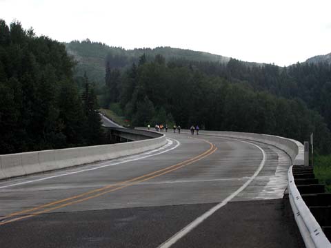 |
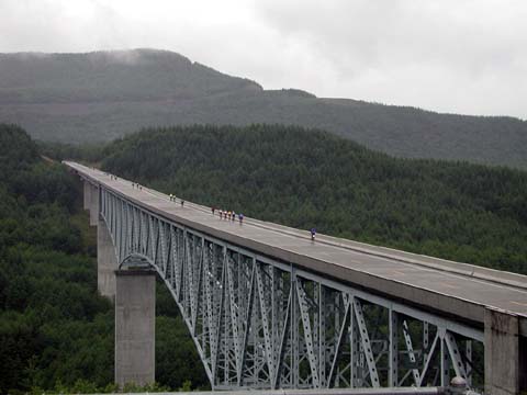
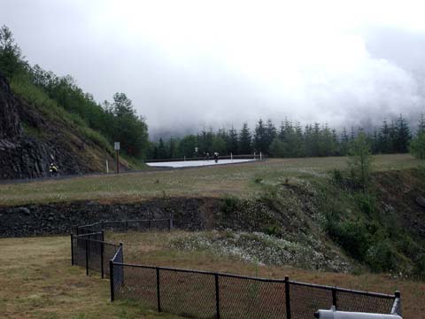
The new section begins at this bridge, just under 1,000′ elevation. By mile 17, we’ll be at the Hofstadt Bluffs rest stop, at 1,400′ elevation. The first stop had a fire going, something I didn’t fully appreciate until my way down. Lovely view, though, and an interesting interpretive center. It’s really surreal to think that I’m standing on top of a seismically active area. In the early 1980s I was watching footage on the TV show Real People. |
||
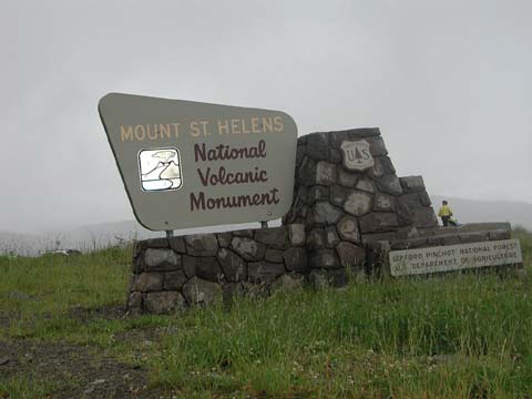
| At mile 20 is the Hoffstadt Canyon Bridge, about 400′ above the creek. We’ve officially entered the volcano’s blast zone, where the volcano flattened over 200 square miles of forest and enough timber to build a half million homes. A lot of this was salvaged by Weyerhaeuser, who “owned” the timber rights. They’ve subsequently planed over 15 million seedlings, which is hard to miss with all the signs telling you when a particular patch was planted, thinned and harvested. The bridge view was taken at a little view point about 100′ above and to the north. |
 |
||
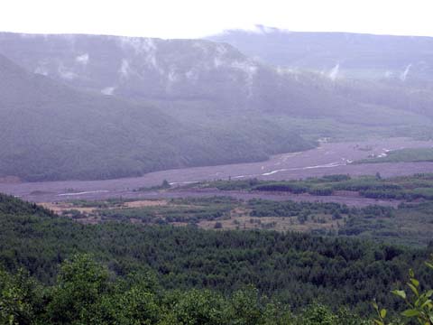   |
We have some spectacular views of the valley. The climb itself runs about eight miles at a 6% grade. It’s long, but seems very manageable. |
||
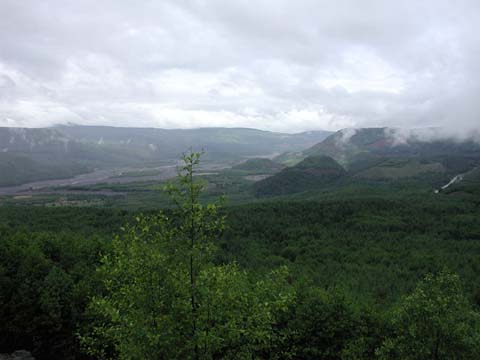
  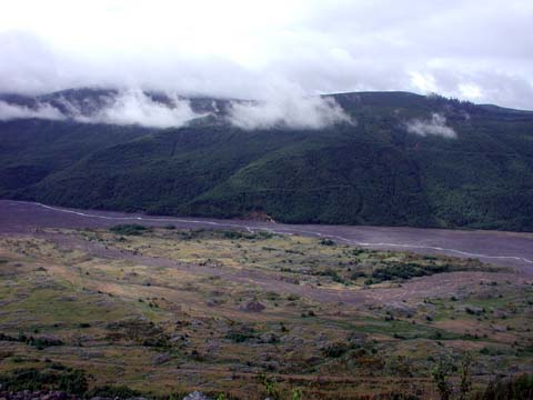    These Theseare some photos taken at the second vista point. As you can see, the weather’s great for cycling. |
|||
 |
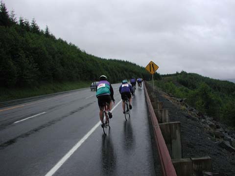
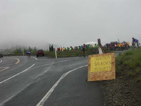
This is Elk Rock, where the road has reached its peak elevation of 3,800′. Shortly after this photo was taken, the weather got really bad. Showers started, it cooled down, and fog moved in, limiting visibility to about 50-100′. Many of the people at the top were ill-equipped for the bad weather. One of the local bike shops brought up a lot of light inclement weather gear and was doing a brisk business. Shelters were limited, and a lot of riders were huddling underneath, preventing anyone from really getting food. Also the lines to the porta-potties were long, as there were only two potties. And, tragedy among tragedies, they ran out of coffee. |
 |
|
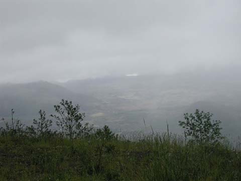 |
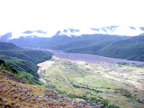
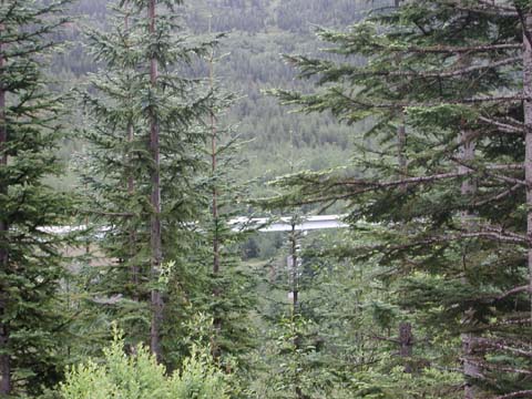
It’s really hard to tell in this picture, but the valley is filled with a grey deposit that used to be the volcano’s summit. When it collapsed, it filled up the valley floor a few hundred feet. If you added a lot of sugar, you could make a giant Oreo sandwich. |
||
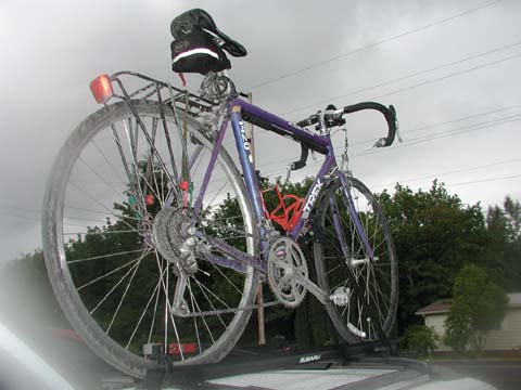
| This is the aftermath of a long ride: bike is covered with volcanic ash… |
 the crank… 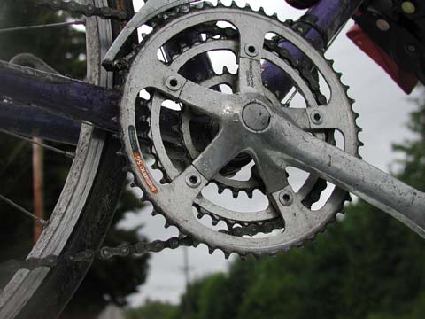 chain 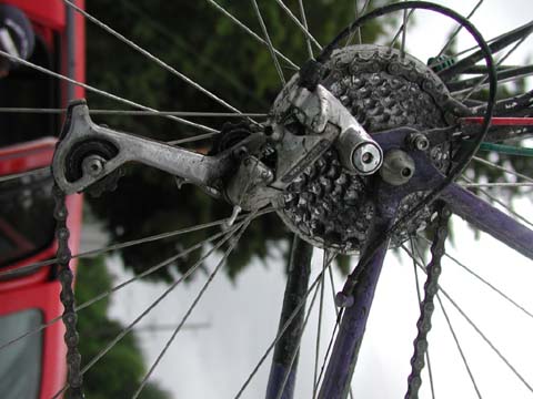 deraileur deraileurand 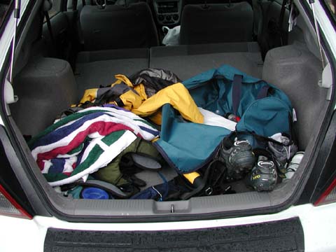 my mycar. |
||
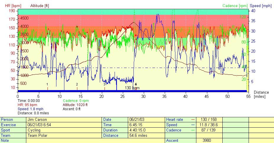
Statistics:
| Mileage | 54.9 |
| Ascent | 3,980′ |
| Average grade | 6% |
| Speed | 11.9 overall, 38.6 maximum down the hill |
| Weather | 40F, showers, windy & fog at the top |
| Duration | 4:30 |
Three folks have written me about the bridge photo. You may order a print from ofoto.com for a very nominal fee. (I don’t make anything off of this, however if you’d like to send me a post card from wherever you live, that’d be great.)
The photos are in reverse chronological order. The shots “before” the car are from a side trip I took to the Windy Ridge viewpoint on the other side of Mt. St. Helens.
I also have some really cool aerial photos.
A better account of the ride can be found at Gardner Cohen’s web site
Hello,
I really like your Tour de Blast blog and I’m hoping to participate in ’08. However looking at that long tall bridge it does give me some second thoughts.
So, even after all of these years since the big eruption you still had ash end up on your bike?
Could you spare some advice for a rookie about this ride 🙂 ?