To help remotivate myself to get outdoors again and, hopefully, lose some of the “Covid 19”, I’ve signed up for the Conditioning Hiking Series with the Mountaineers. This involves two hikes from April to August, a “graduation” hike of >15 miles in September, and a stewardship project.
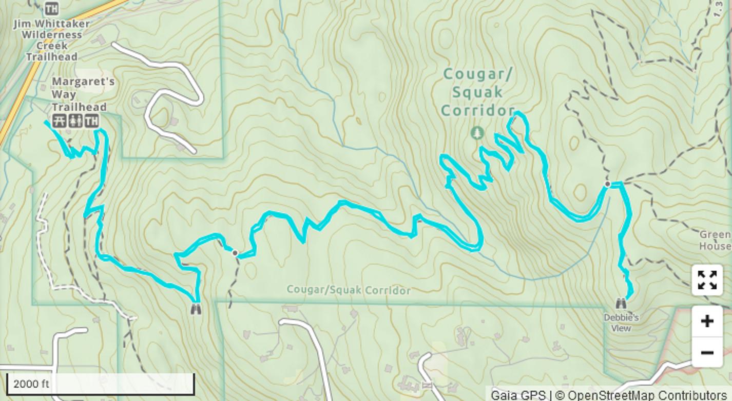
 Map from GaiaGPS based on my track with the parking lot to trailhead portions removed.
There are two tracks:
- CHS 1 — pace of less than 2mph
- CHS 2 — Pace of more than 2mph.
Cool. A few questions: how does one calculate pace? Is it total moving average? Moving time over flat terrain? Distance divided by total time with breaks? No one was able to articulate this in a way that I could nod agreeably in understanding. I was leaning towards the faster group, but unsure about my current couch potato-ness.
To help answer this question, “pacing hikes” were offered this weekend. I opted for one of the harder ones on the Margaret’s Way trail on West Cougar Mountain.
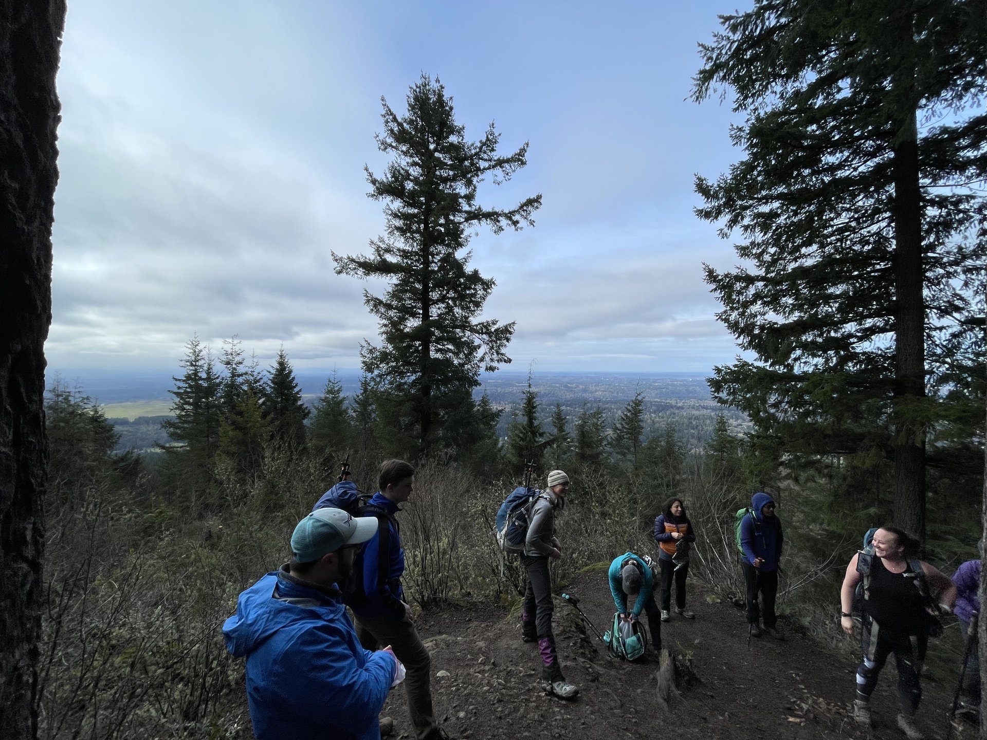 Debbie’s View lunch stop
A few days before the hike, the leaders sent out a pretty thorough email with logistics, contact information, links to the route and weather forecast, and a little bit of history about the specific trail. (Fun fact: this trail opened in June 2015 and honors Margaret MacLeod, a park planner whose long career resulted in the preservation of hundreds of acres in the collective “Issaquah Alps.”) As a chronic planner, this was the level of detail that I needed to feel comfortable.
Since we had two leaders, both of whom completed CHS in earlier years, Ann would be working “sweep” behind the 8 participants while Jacquie led. She offered to show us both paces on the way up.
 The pain from steep gradients is just weakness leaving my body?
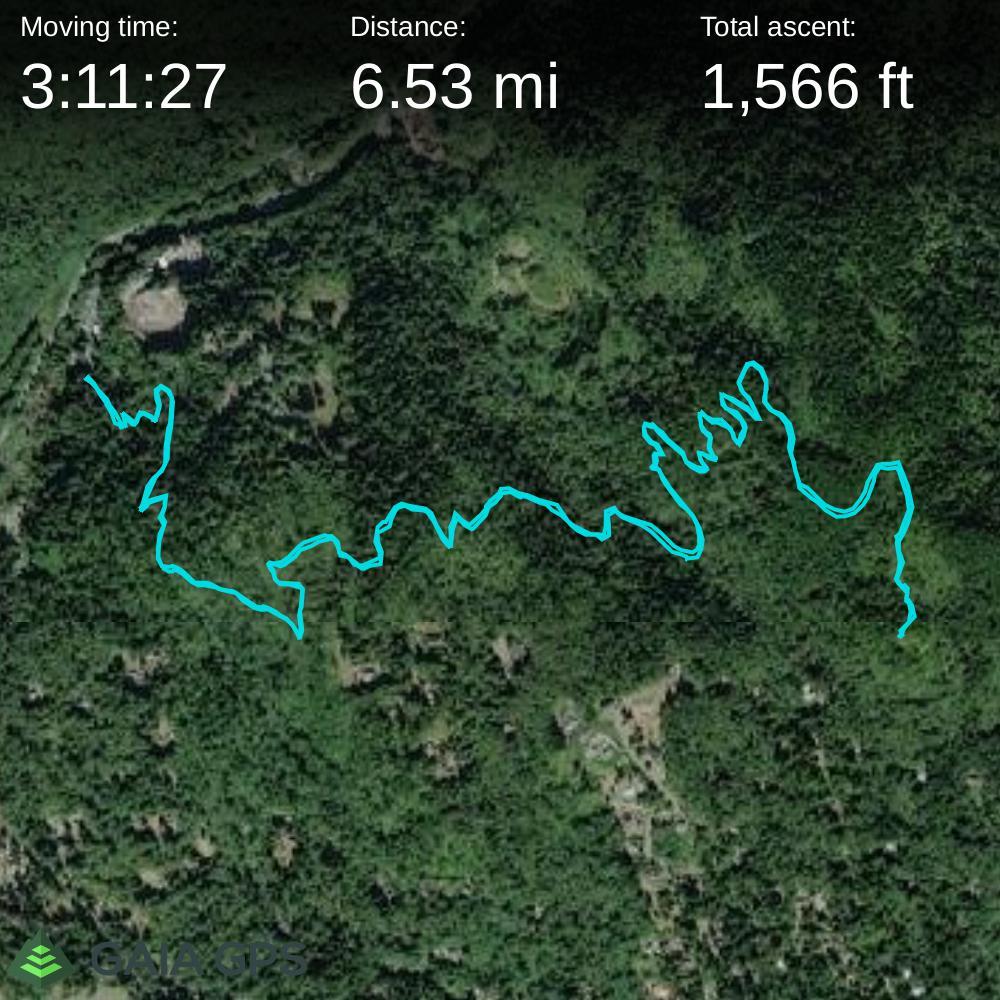
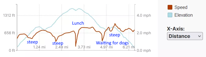
I … got to spend a lot of quality time with Ann and appreciate her patience the five times I needed to stop on the steeper sections. Using my GPS’ track file loaded into GaiaGPS (and removing the parking to trailhead meandering), my moving speed worked out to 2.0 mph:
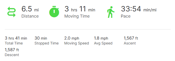 Excluding parking to trailhead & standing around: it’s not bad
Looking at the speed and elevation per distance, I got most slowed down by the steeper climbs. Which is to say, it’s not a bad result, especially considering how inactive I’ve been over the last couple of years:
However, given I was at the caboose of the hiking train for the whole day, and I have few photos from the day, it was an easy decision to realize I’d probably be happier in the slower-paced CHS1.
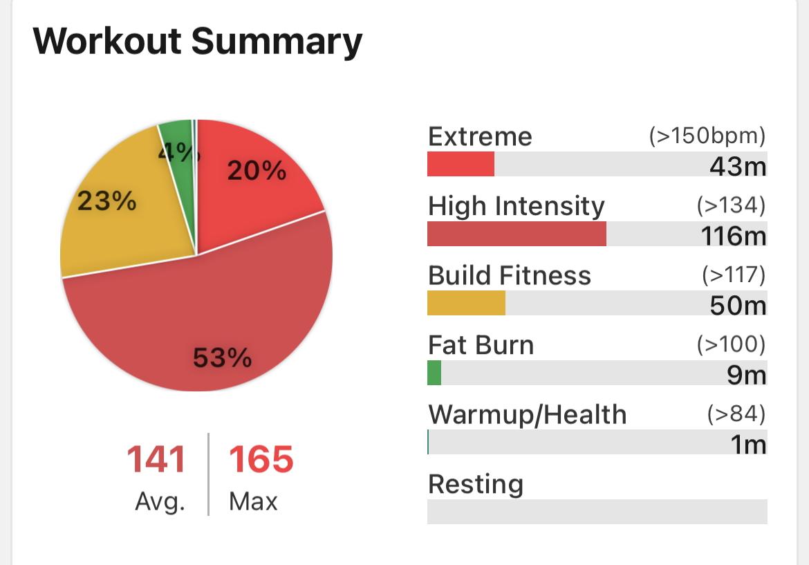 Yes, but how did you feel?
I’d like to think the elevated heart rate is partially influenced from passing up unfound geocaches because I was already slowing the rest of the group down.
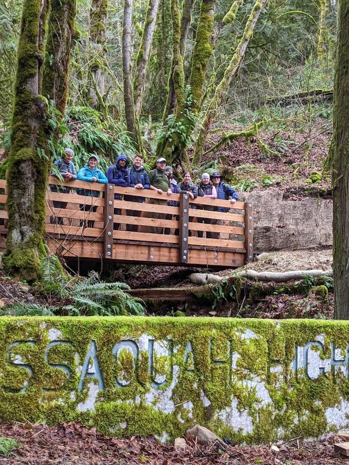 Photo: Jacquie Sinatra
Eaten for the day: burrito, three dried fruit wraps. 2L of water and a container of fresh coffee.