I went to a public hearing this evening discussing the proposals being evaluated for the I-90 floating bridge. This was my first public hearing, and I was expecting fiery rhetoric. Instead, I saw volumes of analysis done and thoughtful people available to explain, to mere mortals, the nuances of a pretty complex issue.
Here are the proposals on the table:
- R-1 is the existing structure, a 3-2-3 configuration with a 10′ shoulder adjacent to the pathway, 32″ concrete barrier and two lanes in the middle switch traffic at time of day.
- R-2B Modified: $30M cost; Same as above, [I]except[/I] center HOV becomes two-way by adding a concrete barrier. Mercer Island SOVs not allowed to use it like they do now.
- R-5 Restripe: $12M cost; Bridge has a 3-2-4 (morning) or 4-2-3 (afternoon) configuration. Shoulder is 14′, but Transit is allowed to use the shoulder — kind of like how I-405 was a few years ago. Center remains reversible, but unidirectional. They erect a debris fence that increases the barrier height to 54″. Closure for one construction season.
- B-5 Modified: $76M cost; Bridge is widened 2′ (and the pathway shifted). Shoulder is reduced to 4′, which means they have to increase the barrier height to 72-96″ (6-8 feet). Construction would take two years.
- R-8A: $100M cost; Bridge is widened to be a 4-2-4 configuration. Center lane is reversible, but unidirectional; Transit uses lanes in outer roadways in both directions. Shoulder is 4′, except for the 1 mile of actual bridge, where it’s 2′. Barrier height is same as above. Construction would take two years.
Neither R1 nor R-2B have significant construction impact.
I learned a lot of fascinating History about the bridge. It was originally built in 1940 and named after Lacey V. Murrow, the current Secretary of the department of transportation. The bridge was in the registry of historical places. However, during maintenance in 1990, a worker left a pontoon valve open on the old section and a chunk of the bridge sank. Another section was later rebuilt and the name changed to Home M. Hadley, after the engineer who conceived of a concrete bridge across Lake Washington.
Other information I learned:
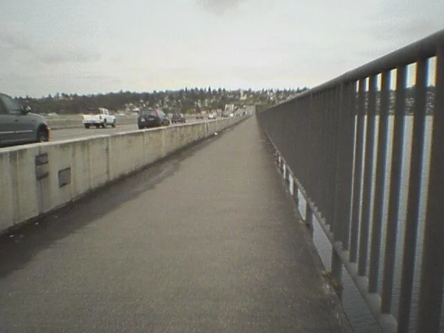
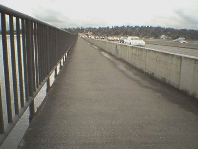
- The bridge is currently in a 3-2-3 configuration, where the “2” lanes in the middle change direction to provide extra capacity during peak traffic.
- The 10′ pedestrian pathway along the bridge will not be narrowed. This contrasts to some earlier rumors I heard.
- The bridge requires continuous maintenance, and has its own dedicated team. Access to the interior — it’s hollow concrete, after all — is on the shoulder in the HOV section. Now I know why I always see a maintenance truck parked on the shoulder, lights flashing, but no one around. (They’re inside.) The access points can’t be moved, which limits the options for configuring traffic. (Otherwise, you theoretically have enough room in the center for three lanes.)
- Noise differences are believed to be in the 1-3db range, which is not easily perceptable to humans. However, this does push the range into the 80s. I found an interesting comparison of the EPA vs ANSI vs OSHA standards. OSHA’s cutoff is 90db for 8 hours. More fascinating exposure facts can be found at OSHA’s web site.
- During construction, they would do either a shuttle or open up the middle section to cyclist (I’m assuming the 8′ shoulder(s) they use now?).
- Approximately 6,000 people use public transit across Lake Washington on peak routes, compared to 1,000 going the other way.
- R-2B Modified would have a negative impact on peak traffic (west in the morning, east in the evening); all options would benefit contra-peak traffic.
- The estimates of potential crashes provided in the hearing were higher than published in the document, but I believe these were 2025 projections.
It seemed like every cyclist there had their own pet question. One lady (Hi Molly) was obsessed about a bumper she saw dumped onto the bikeway during Bike to Work Day. Some random student couple was fascinated by constructing a kryptonite barrier between the cars and the path. Another guy was concerned that the noise increase of a cyclist heading eastbound would be significantly higher because of the proximity to the road. (He was losing hearing in his right ear.)
I interested in the answer to the flow question: even if you add lanes, does the traffic have anywhere to go? As a thought experiment, suppose you expanded it to 6,000 lanes. Crossing the bridge now becomes a spectator sport, until you get to the end and have to frantically merge back into three lanes to actually go somewhere. A more specific example: in the morning, I-90 westbound gets constipated as you get closer to I-5, or more specifically, just past the Rainier exit. In the afternoon, heading east, it chunks up from Bellevue Way to the Eastgate onramp. By adding more lanes, you reduce pressure on I-90, but then you create a condition where you have a bunch of lanes trying to re-merge to a smaller pipeline.
Short answer is there are no projects to connect them any better. The analysis suggest that I-5 and I-405 southbound will further back up. In examining the options, I felt that R-5 Restripe would be fairly straightforward as a first step. It is really a subset of the R-8A, so expansion can be more gradual. I’m still wondering the benefit in expanding the bridge without a better coordinated plan for the connectors